Intelligent Maritime Research Center (IMRC)
Intelligent Maritime Research Center (IMRC), founded in 2021 at National Taiwan Ocean University (NTOU), Keelung, Taiwan, which is currently under the direction of Dr. Sheng-Long Kao from Department of Transportation Science, focuses on independent and long-term research on intelligent technology for ocean observation and advanced engineering. Among the wide range of marine research programs and projects, while acknowledging the effective use of satellite technology, IMRC is currently concentrating on CubeSat technology usage to overcome the Automatic Identification System (AIS) limitation.
IMRC General Information
(1) Purpose and goals : The "National Taiwan Ocean University School-level Intelligent Maritime Research Center" was formally founded in order to strengthen Taiwan's capacity for independent research and development in the field of shipping technology and to increase the country's potential contributions. In order to develop great students in the field of intelligent shipping and to help students develop their innovative and entrepreneurial skills, the school regularly collaborates with corporate organizations. They can look forward to the future through intelligent shipping, where the research center can push the school's energy internationally and establish itself as the gold standard for Intelligent shipping research, by investing their research energy into related industries and society as a contribution after graduation.
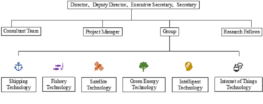
(2) Organizational structure :
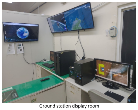
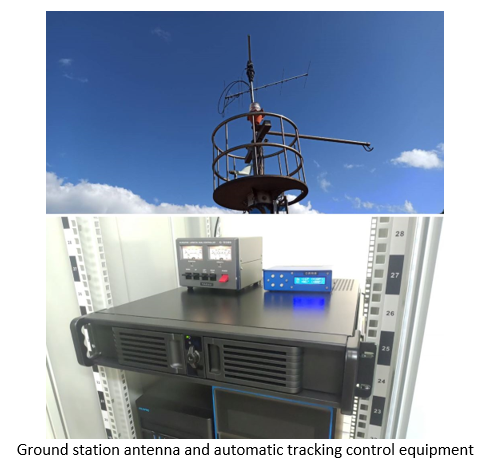
Ground station of NTOU
NTOU have built a ground station located in Room 1003 Yanping Technology Building where IMRC focuses its operational activities.
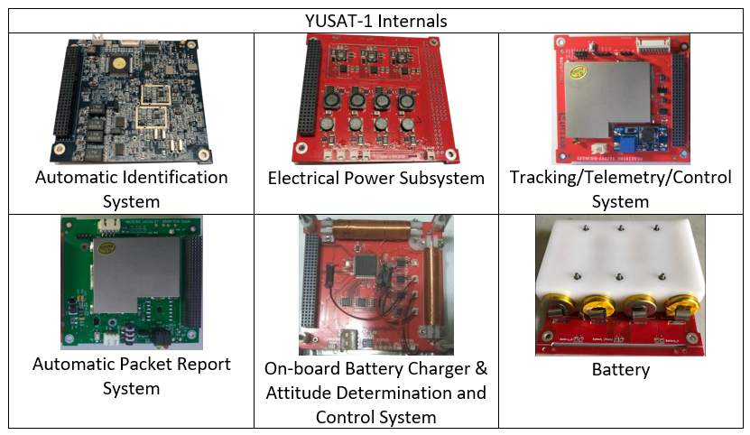
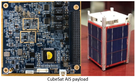
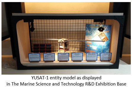
YUSAT-1 Project
YUSAT-1 is a global tracking system of a CubeSat project that was developed using a combination of Automatic Identification System (AIS) and Automatic Packet Reporting System (APRS) technologies, as described below.
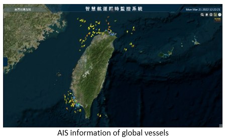
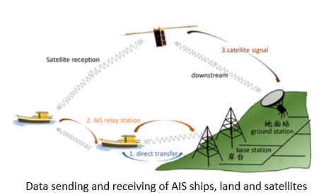
(1) AIS is commonly used between ‘ships and ships’ and ‘ships and shore stations’. The technology uses a range of transceiver devices that are deployed on land, ships, and satellites to communicate ship-specific data to neighboring ships' and shore stations' automated reporting systems through the Global Positioning System (GPS) and Very High Frequency (VHF) radios.
(2) APRS focuses on digitally transmitting information of immediate value in a real time manner within the local area based on an amateur radio. A few examples of the APRS data include GPS coordinates of objects, telemetry weather stations, queries, information in text forms, and announcements. Such data can be depicted on a map that allows to display tracks of moving objects, stations, direction-finding data, fixed objects, search and rescue data.
YUSAT-1 specifications:
- Size
- 1.5U
- Call sign
- BN0YS
- Downlink frequency
- 436.250 MHz
- Altitude
- 530 kilometers
- Detour time
- 96 minutes
- Mission Payload
- Automatic Identification System (AIS) & Automatic Packet Reporting System Receiver (APRS)
- Function
- Receive AIS and APRS messages to track the ship’s trajectory and assist traffic control
- R&D team
- National Taiwan Ocean University, Remotek Corporation, MoGaMe, Letscom
- Launch service
- Odysseus Space